Geotagging
Translated from FrenchFrançais
Putting photos on a map, with or without GPS. An overview of geotagging methods and the tools I used to fill in location metadata.
As my image collection keeps growing, a few months ago I decided to be more careful about the metadata I assign to each picture so that I could manage them better. I set about adding keywords, people's names and so on to each of my images. I did not stop there: wherever possible, I also decided to add the location, as GPS coordinates, where each photo was taken.
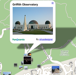
To make the job easier, I decided to get a handheld GPS receiver to record my positions and then assign them to my images. I had started a discussion on several forums to find out how other photographers dealt with the same need. Much to my surprise, the subject seemed to interest quite a few people, each with their own tools or methods. To make use of what had been said, I decided to bring all the information we had exchanged together on this page.
Location and metadata
Geotagging images means adding location metadata to each one. These details go into EXIF/IPTC/XMP fields and include:
- Latitude and longitude
- Altitude
- Country and country code, using ISO 3166
- Region or state
- City
- Location
- Time zone for the different dates, chiefly the time the photo was taken
Naturally, if GPS coordinates are available, it is possible to look up the place, meaning the city, region and country, and its time zone.
General principle
Geotagging images first requires recording where they were taken. There are two ways to do this:
- Have the coordinates, latitude and longitude, inserted into the image metadata when the photo is taken. At present, only a few cameras offer this feature.
- Record a track containing timestamped positions, then work out the images' positions afterwards by comparing their capture times with the track points.
At present, the second method is the most common because it is the only one available to a great many outdoor photographers.
Recording positions
First, how can we record image locations in the field?
Cameras with GPS
The first cameras with built-in GPS receivers are beginning to appear on the market. Cameras such as the Nikon P6000 can record the GPS coordinates of each image as soon as it is taken.
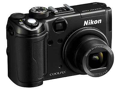
This is by far the simplest and most accurate method, since the exact position recorded by the GPS receiver is inserted into the image.
There is a good chance this approach will become more widespread, or that cameras will gain Bluetooth so they can use a nearby GPS receiver in real time.
Recording a track with a handheld GPS
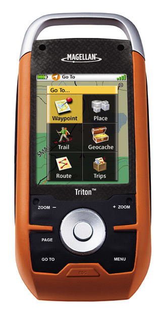
The most common portable GPS is the handheld unit intended for hiking. It is primarily designed for walkers and has a fairly large screen for viewing a map, one's position and movements.
These devices are very useful in the field but were not designed for geotagging images. Many of them do not record large numbers of points while moving, in order to conserve their built-in memory. Instead, they optimise the track by retaining only the points that matter for drawing the route taken. As a result, recorded positions can be quite far apart in both time and distance, making it difficult to geotag images accurately afterwards. Also check that your chosen GPS has a USB interface rather than a serial one for connecting it to your computer, since fewer and fewer computers have a traditional DB-25 serial port.
The main handheld GPS suppliers are:
It will be worth following the iPhone's development. With its built-in A-GPS and a suitable application, it could become a sophisticated track logger.
Recording a track with a GPS data logger
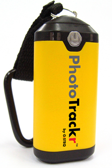
A GPS data logger is a more basic accessory consisting of a GPS receiver, a battery, some memory and a more or less complete interface for viewing one's position.
Its main purpose is to record position at regular intervals. Some models have Bluetooth so that a PDA can use them in real time.
These devices are inexpensive, often have substantial memory and can record a position every second or every five seconds, which is already enough to geotag images fairly accurately.
Things to watch for when buying one include:
- Operating battery life and ease of recharging, including the use of standard cylindrical batteries.
- Enough memory to record the trips you have in mind.
- An adjustable sampling interval.
- Bluetooth support, so a future SLR might be able to use it in the field.
There are many suppliers of this kind of equipment, especially in the USA. Take a look at Semsons and browse their catalogue. With the dollar relatively low against the euro, shopping across the Atlantic may be worthwhile.
Accessories for digital SLRs
Nikon's SLRs are the best suited to this: a cable connected to the accessory socket can link them directly to a GPS and record the position in every image. Canon offers an equivalent feature, but the SLR needs an additional grip or attachment before a GPS can be connected.
There is a small accessory that connects directly to a GPS over Bluetooth: the Blue2Can. With it, a Nikon camera can access a nearby Bluetooth GPS in real time.
Adding location metadata to images
Once we have a track file, or even images that already contain coordinates, the next step is to use that information and update the relevant metadata.
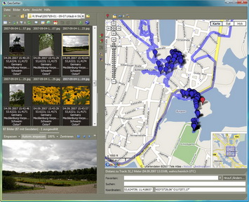
Here is a selection of the most useful programs for working with GPS metadata in images. They can synchronise images with GPS track files, and some can also look up place information, such as country, region and city names, on the Internet.
- Free:
- GeoSetter - Microsoft Windows XP, Microsoft Windows Vista
- Microsoft Pro Photo Tools - Microsoft Windows XP, Microsoft Windows Vista
- GPS synchronisation plugin for Adobe Lightroom: GeoTag - Mac OS X, Microsoft Windows XP, Microsoft Windows Vista
- GPS Photo Linker - Mac OS X
- GeoTag - Mac OS X, Microsoft Windows XP, Microsoft Windows Vista
- Paid:
- OziPhotoTool - $25 for commercial use - Microsoft Windows XP, Microsoft Windows Vista
- RoboGEO - $39.95 for personal use, $79.95 for commercial use - Microsoft Windows XP, Microsoft Windows Vista
- HoudahGeo - $30 for individual use, $15 for students, $40 for home use by up to five users - Mac OS X
- Downloader Pro - $29.95, for software whose main purpose is something else - Microsoft Windows XP, Microsoft Windows Vista
My own choice is GeoSetter, which is free, comprehensive and pleasant to use.